Open 0 days Ref PV-AUYE2R
Bridge Road, Richmond
First reported 11 October 2026 · Department of Transport and Planning
Every report on Bridge Road Every report in Richmond
The record
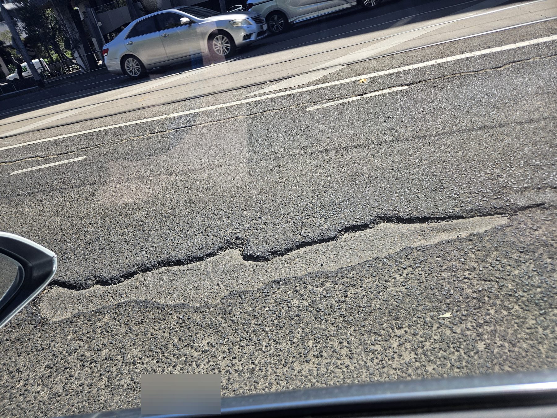
- Photographed
- 10 Oct 2026, 11:50 am AEDT
- Published
- 11 Oct 2026, 2:37 pm AEDT
- Location from
- placed by hand
- Coordinates
- -37.820130, 145.013820
- Lane
- right, heading west
- Size
- large · coin
“Long pothole exposing the layer underneith”
Responsible authority
Department of Transport and Planning
Bridge Road is managed by DTP (0 m from the reported point).
Their reporting channel →Under the Road Management Act, whether an authority knew about a defect — and when — is central to any later claim. This page is that date, in public.
Driven past it recently?
One tap keeps the register honest.
Marking it fixed will ask for a photo — that photo is what makes the repair date stand up later.
History
- Reported and published · 11 Oct 2026, 2:37 pm AEDT