Nepean Highway, Mount Martha
First reported 12 October 2026 · Department of Transport and Planning
Every report on Nepean Highway Every report in Mount Martha
The record
- Photographed
- 12 Oct 2026, 9:58 pm AEDT
- Published
- 12 Oct 2026, 9:58 pm AEDT
- Location from
- placed by hand
- Coordinates
- -38.246574, 145.037359
- Lane
- left, heading west
- Size
- medium · fist
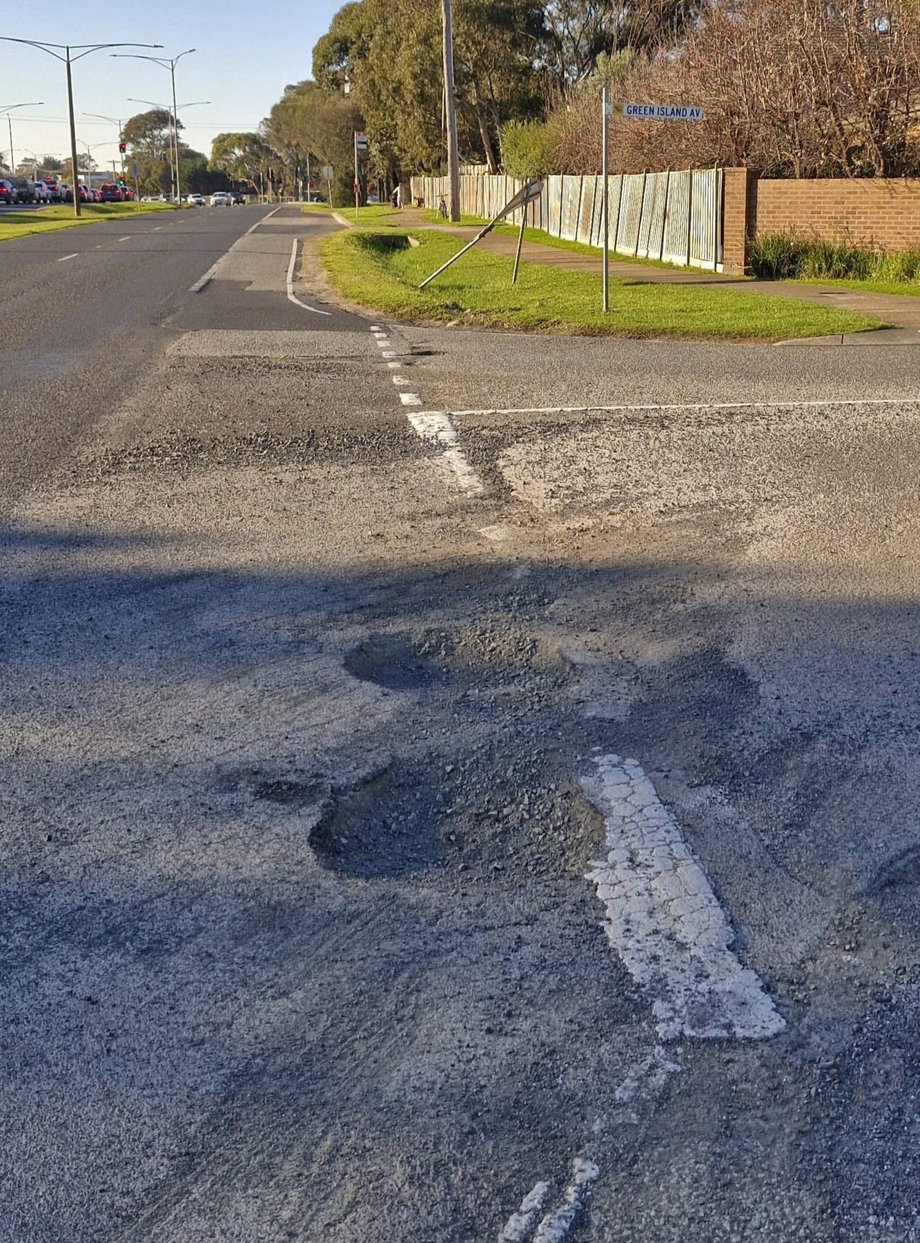
“For the past 5 weeks these craters have gradually been getting more dangerous. Corner of Green Island & the Nepean Hwy. Mt Martha.”
Responsible authority
Department of Transport and Planning
Nepean Highway is managed by DTP (2 m from the reported point).
Their reporting channel →Under the Road Management Act, whether an authority knew about a defect — and when — is central to any later claim. This page is that date, in public.
Department of Transport and Planning has this report
Lodged through their own reporting channel by potholesvictoria.org on 12 Oct 2026, 10:04 pm AEDT, and acknowledged.
- Their reference
- ETS503768309
That reference is theirs, not ours. It is published so anyone — a claimant, a journalist, the authority itself — can check this record against the authority's own, rather than taking our word for it.
Driven past it recently?
One tap keeps the register honest.
Marking it fixed will ask for a photo — that photo is what makes the repair date stand up later.
History
- Reported and published · 12 Oct 2026, 9:58 pm AEDT
- Acknowledged by Department of Transport and Planning · 12 Oct 2026, 10:11 pm AEDT · their reference ETS503768309